The reason? Several model runs at that time had scary forecasts, such as this one for 4 PM Thursday (tomorrow). The kind of strong low that would easily take out power to hundreds of thousands of local customers.
That is why I did not blog about it.
We are close enough now to have a good idea of what will occur tomorrow… the rapid development of a strong low off the California coast.
A low center that will dissipate almost as quickly as it developed.
Here is the pressure analysis for 4 AM this morning. An amorphous 1002 hPa low-pressure center off of northern California. Yawn.
Now look at the forecast for 4 AM Thursday morning: a 986 hPa low has formed. Impressive.
A deepening of 16 hPa in 24 h. Not quite the bomb rate (24 hPa in 24 h), but very substantial.
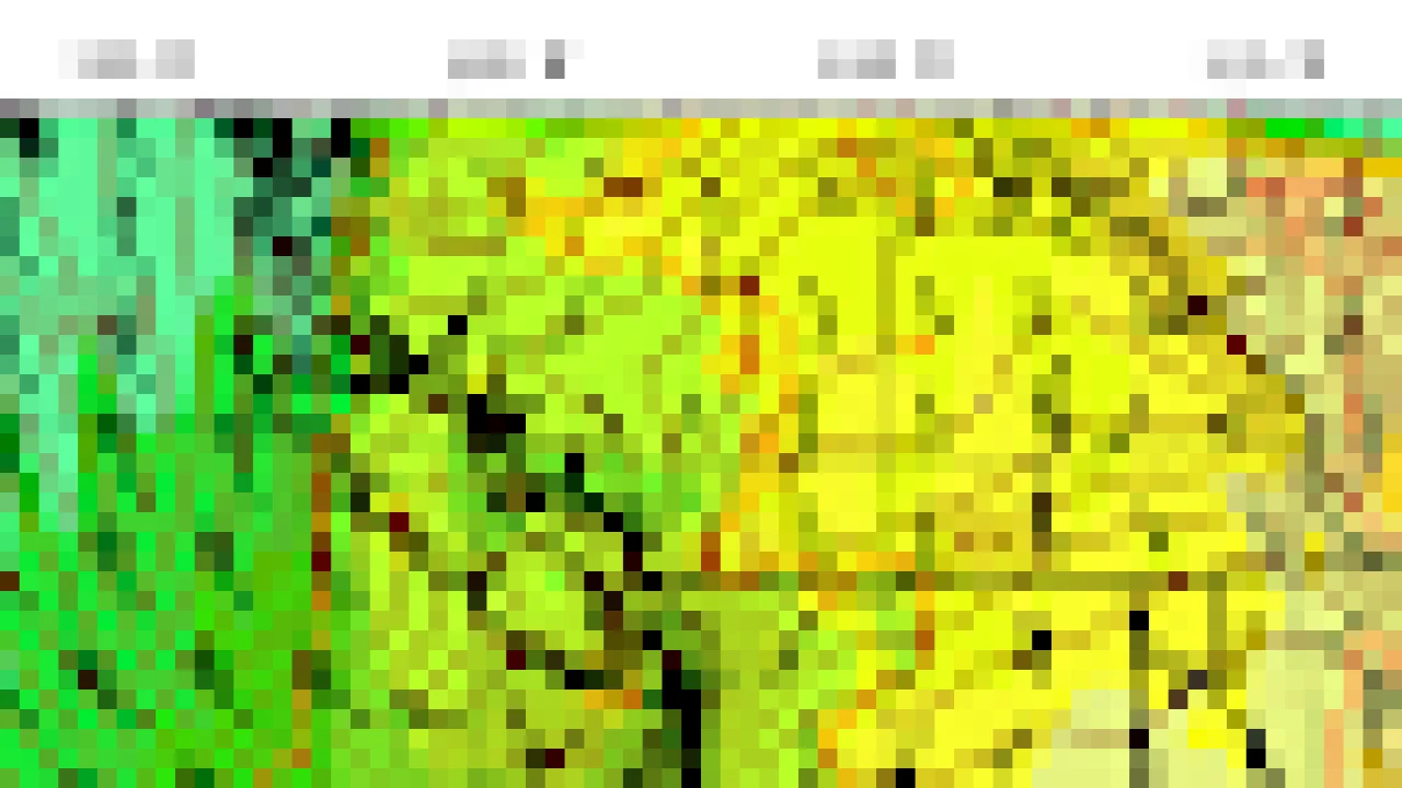
The water vapor satellite imager tonight (8:30 PM) was quite impressive: